Overview of Geomatics
It is the integrated approach of measurement, representation, analysis, management, storage, retrieval, and display of spatial data concerning both the earth's physical features and the built environment. The data comes from various sources, including earth-orbiting satellites (GPS), air and sea-borne sensors (Aerial photography and LIDAR), and ground-based instruments (Levels, Total Stations). It has applications in all disciplines that depend on spatial data, including environmental studies, planning, engineering, navigation, geology and geophysics, oceanography, land development, and land ownership and is thus fundamental to all the geoscience disciplines that use spatially related data.
Our Geomatic Service's include:
- Geographical Information System (GIS)
- Terrain-based LIDAR/ Laser Scanning
- Asset location and inventory
Through our software, we have the ability to collect and inventory features and their associated attributes and integrate this data into a database for use by the client. Some examples of how this information can be used.... Better planning for future projects; Increased response time to emergencies; Evaluation of current infrastructure systems.
Some Links of interest - Geomatics publications:
www.esri.com/news/arcnews/
www.carlson-GIS.com
www.GIM-international.com
Please contact us to discuss how Hoffman Land Surveying and Geomatics can assist you in the success of your next project.
Terrain-based LIDAR/ Laser Scanning
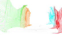
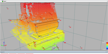
This is the latest technology being utilized to acquire geospatial data through the use of pulse light beams which create a "cloud" of point data as well as images of a scanned feature.
Point cloud data is processed through software which is commonly imported to a CAD environment where the data is utilized to create a more traditional 3D representation of the scanned feature.
There are many applications for this type of survey, from topographical ground features, such as highways, bridges, and buildings to building interiors for use in determining and locating mechanical and electrical features.
Additionally, it is also being utilized for non-traditional surveys such as forensics at accident sites and "recording" historical site features.


Although this method of survey is generally more expensive than traditional methods, there are several benefits to using this technology. Some of these include Safety in high-traffic areas, accuracy, the ability to process previously acquired cloud data and images for potential future projects or expansion of a current project scope which may result in a reduction of the amount of additional time spent in the field to acquire additional data.
Please contact us to discuss how Hoffman Land Surveying and Geomatics can be of assistance with your next project and how utilizing scanning techniques may be a consideration for your project.
Asset Location and Inventory Services
This is a service for individuals, institutions, and municipalities who need to acquire as-built information on features that are or have been recently installed and may already have a management system in place for managing geospatial data.
This service is also for individuals, municipalities, and institutions in need of locating subsurface infrastructure features related to municipal, private, and transport system utilities that have or will be marked on the surface by a Subsurface Utility Engineer (SUE). The markings are located and referenced to a known horizontal and vertical datum that may be local to the specific utility or to a statewide system.
We also have the capability to assign attributes to the utilities, if additional information is known and available, such as pipe size, pipe depth, identifier, etc.
Have you had a project where a utility contractor has come out and marked the area where anticipated construction is planned? We can locate these markings and provide a "record" of their location for future reference. The new features could also be located for future reference.
Please contact us to discuss how Hoffman Land Surveying and Geomatics can be of assistance with your next project and how asset location and inventory may be a consideration for your project.

Geographical Information System (GIS)
Hoffman Land Surveying and Geomatics can assist you with the acquisition and management of your infrastructure assets, such as storm, sanitary, water, sign, and other private and municipal data related to County, Town, and Village municipalities as well as institutions such as educational campus and related facilities.
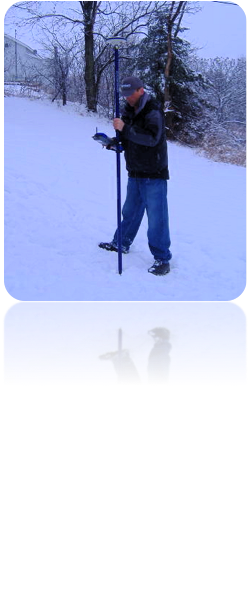
Through the use of our hardware and software, such as GPS and ESRI/ Carlson software, Hoffman Land Surveying and Geomatics can assist you in several ways, from acquiring the spatial data of your existing infrastructure assets in the field, through the use of record information or through the use of a Subsurface Utility Engineer (SUE) consultant, to assisting in the management of the acquired spatial data.
We also have the ability to assign attributes to data as its collected during the field operation, if data such as identifiers, pipe type, pipe size, etc. are known at the time.
If you have a Geographical Information System in place, but are in need of assistance with additional asset locations or acquiring the attributes related to your assets, Hoffman Land Surveying and Geomatics can assist you in this area as well. See our asset location and inventory for more details.
Please contact us to discuss how Hoffman Land Surveying and Geomatics can be of assistance with your GIS needs.


